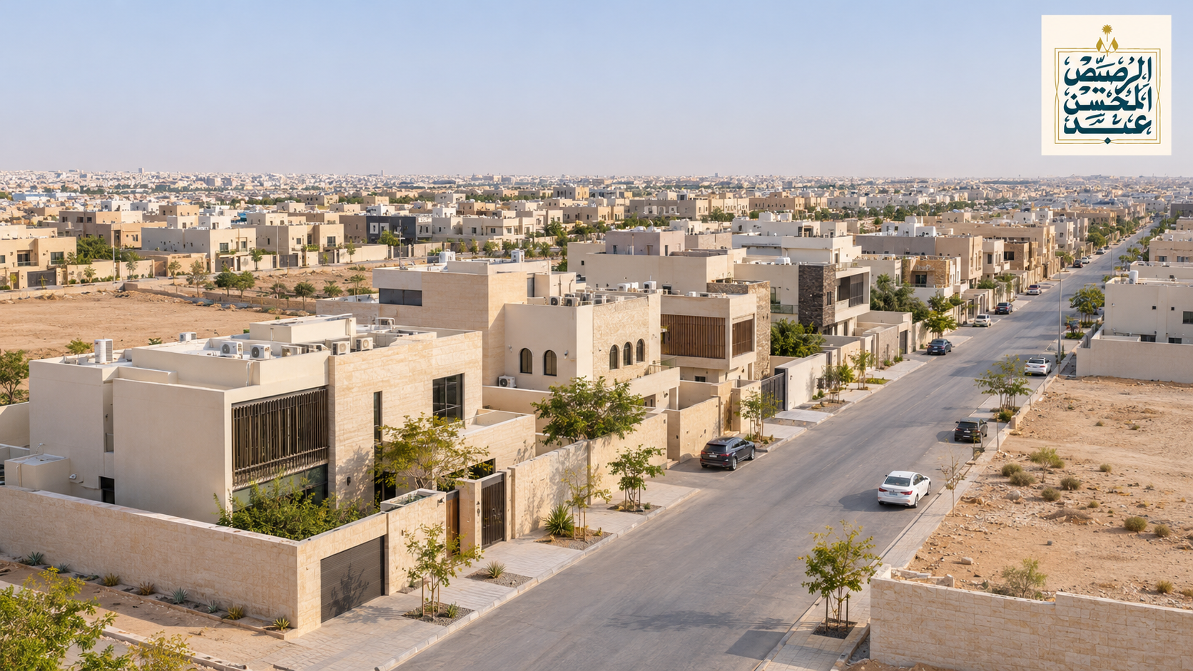
Al Arid Riyadh: Location, Boundaries, Services & Living Guide (2026)
Al Arid is a residential district in north Riyadh, Saudi Arabia, located north of King Salman Road between King Fahd Road to the west and Abu Bakr Al-Siddiq Road to the east. This guide to Al Arid district, Riyadh, covers where it is, how to get around, which services are nearby, and what to check before you rent or buy.
Median residential price5,900 SAR/m² (12 months to June 2026)
Key adviceJudge the street and the unit, not just the district name
Al Arid Riyadh at a Glance
Item
Details
Source / date
Arabic name
حي العارض (Hay Al Arid)
—
Location
North Riyadh, Saudi Arabia
Google Maps, Nov 2026
Bounding roads
King Fahd Road (west), King Salman Road (south), Abu Bakr Al-Siddiq Road (east)
Google Maps district boundary, Nov 2026
Roads inside
King Abdulaziz Road and Special Forces Street
Google Maps
Neighboring districts
Al Qirawan (west), Al Narjis (east), Al Yasmin (south)
Google Maps
Metro
SAB station, the northern end of the Riyadh Metro Blue Line
Google Maps, Nov 2026
Median residential price
5,900 SAR/m² from 121 residential deals, July 2025 – June 2026
Raghdan, based on Ministry of Justice deal data, updated 7 Aug 2026
Where Is Al Arid in Riyadh?
Short answer: Al Arid is inside Riyadh city, in its northern part. King Fahd Road forms its western edge, King Salman Road its southern edge and Abu Bakr Al-Siddiq Road its eastern edge, and the district stretches north toward the city's outer edge.
To picture the Al Arid Riyadh location, think of a long, narrow district running north from King Salman Road. Its southern part sits closer to the metro and to the established districts south of King Salman Road, while the northern part still has more vacant land. If you are comparing several districts in this part of the city, see our guide to north Riyadh neighborhoods.
Al Arid Boundaries and Neighboring Districts
Side
Boundary
Neighbor
West
King Fahd Road
Al Qirawan
South
King Salman Road
Al Yasmin
East
Abu Bakr Al-Siddiq Road
Al Narjis
North
Northern edge of the city
Largely undeveloped land
Source: Al Arid district boundary on Google Maps, November 2026. Map boundaries are approximate; for a specific property, the title deed or National Address is the reference.
Main Roads and Driving Distances
King Fahd Road (west edge) runs south to KAFD and the Olaya area.
King Salman Road (south edge) links east–west across north Riyadh and was the fastest route to the airport in our check.
Abu Bakr Al-Siddiq Road (east edge) separates Al Arid from Al Narjis.
King Abdulaziz Road and Special Forces Street run through the district.
Destination
Distance
Drive time
King Khalid International Airport
27.5 km
about 32 min (via King Salman Rd)
Al Malqa
15.7 km
about 23 min
King Abdullah Financial District (KAFD)
24.5 km
about 46 min (traffic on King Fahd Rd)
One Google Maps measurement from the district's map point, Saturday 14 November 2026, early evening. Times change with your start point and traffic.
In brief: Al Arid is a newer district that is still growing. Some blocks are fully built with villas, floors and apartments, while other parts, especially in the north, still have vacant plots and active construction.
Housing types
Villas and duplexes: among the most common property types in Al Arid listings.
Floors and apartments in villas: widely offered for rent; entrances, meters and parking vary a lot.
Newer apartment buildings: some within compounds with shared facilities.
Residential land: still offered for sale in several parts of the district.
Why the experience changes from street to street
Main road vs. inner street: easier access and shops on main roads, but more traffic and noise.
Finished vs. developing block: fully built streets are usually quieter than streets next to construction sites.
South vs. north: the south is closer to King Salman Road and the metro; the far north is further from both.
Services and Facilities in Al Arid
The names below were checked on Google Maps in November 2026; most appear in Arabic on maps and apps.
Schools in Al Arid
Al Maali Schools, Al Mutaqaddimah Private Schools, Al Tarbiya Al Namuthajiya private and international schools on Abu Bakr Al-Siddiq Road, Bilingual Learning Schools – Al Arid, a girls' primary school, and several kindergartens.
Dallah Hospital Al Arid and clinics
Dallah Clinics Al-Arid already operate in the district. Dallah Healthcare is building a 250-bed Al-Arid Hospital at Abu Bakr Al-Siddiq Road and Prince Saud bin Abdullah bin Jalawi Street, with operations targeted for Q1 2027. Nearby today: Dr Sulaiman Al Habib Medical Center – Al Narjis.
Metro and transport
SAB station (محطة البنك الأول), the northern end of the Blue Line (Line 1), is in the southern part of Al Arid, north of King Salman Road, with trains south to KAFD and Olaya. Elsewhere in the district, daily life depends mainly on the car; check bus routes in the Darb app.
Mosques, shops and university
Abdullah bin Nasser Al-Muhaini Mosque and Sheikh Mohammed bin Saleh Al-Saif Mosque. Shops and cafés concentrate on Special Forces Street and King Abdulaziz Road. Al Yamamah University sits on King Fahd Road at the district's western edge.
Hospital details: Dallah Healthcare announcements reported by Argaam (April 2023 and June 2024). Construction timelines can change, so check the hospital's status before relying on it.
Is Al Arid a Good Area to Live In?
It depends on your daily route: Al Arid suits people who work in north Riyadh, near the airport or along the Blue Line and want a newer home. It may suit you less if you commute to central or south Riyadh at peak hours.
A good fit if
May not suit you if
You work in north Riyadh or near King Khalid Airport
You commute to central or south Riyadh at peak hours
You want a newer villa, floor or apartment
You want a fully built street with no construction nearby
You will live in the south of the district near the metro
You will live in the far north and rely on public transport
Framed by King Fahd, King Salman and Abu Bakr Al-Siddiq roads, with King Abdulaziz Road running through it.
A metro station on the Blue Line in the south of the district.
The airport is 27.5 km away in our measurement.
Newer housing stock and a range of private and international schools.
Drawbacks and what the sources say
Issue
What the sources say
Street condition
Al-Yaum reported worn asphalt and potholes in Al Arid (October 2022); Riyadh Municipality carried out road maintenance in part of the district (March–April 2026).
Vacant land and construction
Satellite imagery on Google Maps shows undeveloped plots between built blocks, more so in the north.
Resident rating
Average 2.8 out of 5 in residents' poll on the Aqar platform (Aqar blog, last updated June 2025).
Commute south
About 46 minutes to KAFD in our measurement, with traffic on King Fahd Road.
Al Arid Property Prices: How to Read the Data
5,900SAR/m² · median residential price
121residential sale deals in the last 12 months
42rank among 177 Riyadh districts by median price per m²
Period: July 2025 – June 2026. Source: Raghdan, based on Ministry of Justice deal data, updated 7 August 2026.
The median for the previous 12 months was 8,076 SAR/m². That gap does not mean every property lost the same value: the median moves with the mix of deals in each period (land, villas or apartments) and where they sit in the district. Always compare similar properties by type, size, street width, facade and age. To read deal data correctly, see how to read Riyadh real estate sales count and value.
Checklist Before Renting or Buying in Al Arid
Visit the property in the day and at night to judge lighting, noise and traffic.
Test your commute to work and school at peak hours.
Match the district named in the ad with the title deed or National Address.
Inspect the street: asphalt, pavements and drainage.
Ask about nearby construction and how long it will last.
Confirm separate electricity and water meters, and allocated parking.
Verify the property ad license and the advertiser's identity.
Al Arid is not on the Northern Ring Road; it lies north of King Salman Road. You reach it from King Fahd Road on the west, Abu Bakr Al-Siddiq Road on the east, or King Abdulaziz Road, which runs through the district. The best entry depends on where you start.
Is there a metro station in Al Arid?
Yes. SAB station, the northern end of the Riyadh Metro Blue Line, is in the southern part of Al Arid, north of King Salman Road. From there the line runs south to KAFD and Olaya. The northern parts of the district are beyond walking distance from it.
Is there a hospital in Al Arid?
Dallah Clinics Al-Arid already operate in the district. Dallah Healthcare is building a 250-bed Al-Arid Hospital on Abu Bakr Al-Siddiq Road, with operations targeted for Q1 2027. Until it opens, the nearest large facility is Dr Sulaiman Al Habib Medical Center in neighboring Al Narjis.
What is the postal code of Al Arid, Riyadh?
Al Arid uses more than one postal code; addresses in the district on Google Maps include 13331 and 13338. Check the exact code for a building through the Saudi National Address service.
How far is Al Arid from Riyadh airport?
In our Google Maps check on 14 November 2026, the drive from Al Arid to King Khalid International Airport was 27.5 km and took about 32 minutes via King Salman Road. Times vary with traffic and your start point.
Is Al Arid in Riyadh the same as Al Aridh in Madinah?
No. This guide covers Al Arid in north Riyadh; Madinah has a separate district with a similar name. In Arabic the Riyadh district is حي العارض, and you may also see it spelled Al Aarid or Al Aridh in English.
Summary
Al Arid Riyadh is a newer residential district north of King Salman Road, between King Fahd and Abu Bakr Al-Siddiq roads, with a Blue Line metro station at its southern end and a large hospital under construction. It generally suits people who work in north Riyadh, but living there varies a lot from street to street. Before you decide, inspect the street, test your daily commute and match the property's location with its deed. To compare nearby districts, start with our north Riyadh neighborhoods guide.